When you click on links to various merchants on this site and make a purchase, this can result in this site earning a commission. Affiliate programs and affiliations include, but are not limited to, the eBay Partner Network.

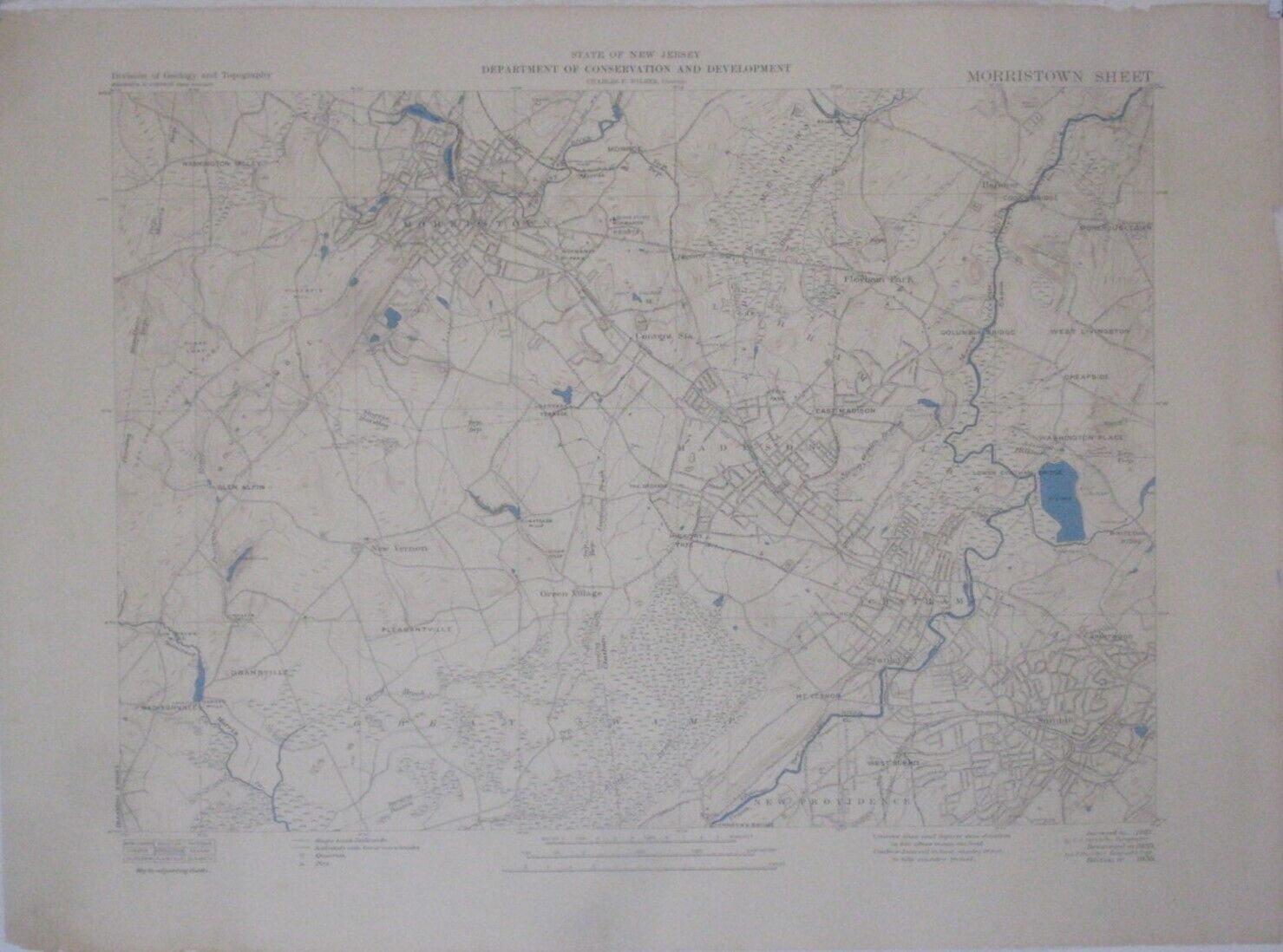
1939 Map MORRISTOWN MADISON CHATHAM SUMMIT New Jersey Convent Station New Vernon:
$79.99
Original large-format map of part of Morris County, with adjoiningportions of Union, Essex, and Somerset counties,published more than 85years ago by the State of New Jersey Department of Conservation andDevelopment. - It is identified as theMorristown Sheet, with an overallsize of a very generous 27" x 37".
- It is drawn on ascale of 1:28,160, and the coverage area is bounded by longitude 74°20'W to74°33' Wand latitude40°42' N to 40°49' N.
- It is the 1939 edition of the original 1887 survey byCornelius Clarkson Vermeule,resurveyed in 1939.
- Details include street names, railroads, townshipand borough boundaries, golf courses, rock quarries, pumping stations,transmission lines, andnaturalfeatures, with elevations in feet above mean sea level.
- Among the specific namedplaces and features are Jockey Hollow Road, Harding Township, LoantacaTerrace, Green Village,Bailey's Mills, Whiteoak Ridge, National Historical Park, West Summit,Glen Alpin,Lower Chatham Bridge, Florham Park, Hickory Tree, Kent Place Boulevard,East Madison, Monroe, Convent Station,Washington Valley, Southern Boulevard, Stanley, Black Meadows, PassaicRiver,Brantwood, New Providence, Silver Lake, Pleasantville, Cheapside,Summit Avenue, Whippany River, West Livingston,SpeedwellLake, Fort Nonsense, Mount Kemble, Olmstead's Mills, Morehousetown,Canoe Brook Parkway,Lake Pocahantas, Gillespie Hill, New Vernon, and the Delaware,Lackawanna & Western Railroad.
- Condition: The map is in very good condition,bright and clean, with nomarks or writing. The paper has stiffened slightly, and there are a fewtiny chips and closed tears along the right margin.It is blank on the back, with noprinting on the reverse side. Please seethe scans andfeel free to ask anyquestions.
- It has never been folded, and wewill ship it to you carefully rolled in a sturdy tube.
- We may also have the map covering the area to the southof this oneavailableinourstore. It islisted asitem # 276389255196 and includes Berkeley Heights, Stirling, Millington,Watchung Reservation, and Plainfield. If you'd like to take a look,simply click here.
- Buy with confidence! We are always happy to combineshipping on thepurchase of multiple items — just make sure to pay for everythingat one time, not individually.
Powered by SixBit's eCommerce Solution

|


